Powerpoint Templates and Google slides for Regional Map
Save Your Time and attract your audience with our fully editable PPT Templates and Slides.
-
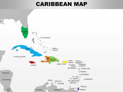 0714 caribbean region powerpoint maps showing bahamas haiti etc
Use of high-resolution, pixel friendly graphics in the slide design. Access to customize the entire ribbon of the slide icon. Allow to adjust the aspect ratio or the cropping of images. Offer insertion of elements from online platforms. Enjoy removing background and redesigning it. Functional for the business managers, marketing people, developers and relevant employees.
-
 Usa midwest region country powerpoint maps
These high quality, editable powerpoint state maps have been carefully created by our professional team to display location and other geographic details in your PowerPoint presentation. Each map is vector based and is 100% editable in powerpoint. Each and every property of any region - color, size, shading etc can be modified to help you build an effective powerpoint presentation. Use these maps to show sales territories, business and new office locations, travel planning etc in your presentations. Any text can be entered at any point in the powerpoint map slide. Simply DOWNLOAD, TYPE and PRESENT!
-
 Usa northeast region country powerpoint maps
These high quality, editable powerpoint state maps have been carefully created by our professional team to display location and other geographic details in your PowerPoint presentation. Each map is vector based and is 100% editable in powerpoint. Each and every property of any region - color, size, shading etc can be modified to help you build an effective powerpoint presentation. Use these maps to show sales territories, business and new office locations, travel planning etc in your presentations. Any text can be entered at any point in the powerpoint map slide. Simply DOWNLOAD, TYPE and PRESENT!
-
 Usa rocky mountain region country powerpoint maps
These high quality, editable powerpoint state maps have been carefully created by our professional team to display location and other geographic details in your PowerPoint presentation. Each map is vector based and is 100% editable in powerpoint. Each and every property of any region - color, size, shading etc can be modified to help you build an effective powerpoint presentation. Use these maps to show sales territories, business and new office locations, travel planning etc in your presentations. Any text can be entered at any point in the powerpoint map slide. Simply DOWNLOAD, TYPE and PRESENT!
-
 Usa south region country powerpoint maps
These high quality, editable powerpoint state maps have been carefully created by our professional team to display location and other geographic details in your PowerPoint presentation. Each map is vector based and is 100% editable in powerpoint. Each and every property of any region - color, size, shading etc can be modified to help you build an effective powerpoint presentation. Use these maps to show sales territories, business and new office locations, travel planning etc in your presentations. Any text can be entered at any point in the powerpoint map slide. Simply DOWNLOAD, TYPE and PRESENT!
-
 Usa pacific region country powerpoint maps
These high quality, editable powerpoint state maps have been carefully created by our professional team to display location and other geographic details in your PowerPoint presentation. Each map is vector based and is 100% editable in powerpoint. Each and every property of any region - color, size, shading etc can be modified to help you build an effective powerpoint presentation. Use these maps to show sales territories, business and new office locations, travel planning etc in your presentations. Any text can be entered at any point in the powerpoint map slide. Simply DOWNLOAD, TYPE and PRESENT!
-
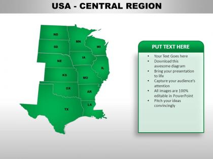 Usa central region country powerpoint maps
These high quality, editable powerpoint state maps have been carefully created by our professional team to display location and other geographic details in your PowerPoint presentation. Each map is vector based and is 100% editable in powerpoint. Each and every property of any region - color, size, shading etc can be modified to help you build an effective powerpoint presentation. Use these maps to show sales territories, business and new office locations, travel planning etc in your presentations. Any text can be entered at any point in the powerpoint map slide. Simply DOWNLOAD, TYPE and PRESENT!
-
 Usa eastern region country powerpoint maps
These high quality, editable powerpoint state maps have been carefully created by our professional team to display location and other geographic details in your PowerPoint presentation. Each map is vector based and is 100% editable in powerpoint. Each and every property of any region - color, size, shading etc can be modified to help you build an effective powerpoint presentation. Use these maps to show sales territories, business and new office locations, travel planning etc in your presentations. Any text can be entered at any point in the powerpoint map slide. Simply DOWNLOAD, TYPE and PRESENT!
-
 Usa mountain region country powerpoint maps
These high quality, editable powerpoint state maps have been carefully created by our professional team to display location and other geographic details in your PowerPoint presentation. Each map is vector based and is 100% editable in powerpoint. Each and every property of any region - color, size, shading etc can be modified to help you build an effective powerpoint presentation. Use these maps to show sales territories, business and new office locations, travel planning etc in your presentations. Any text can be entered at any point in the powerpoint map slide. Simply DOWNLOAD, TYPE and PRESENT!
-
 Usa south west region country powerpoint maps
These high quality, editable powerpoint state maps have been carefully created by our professional team to display location and other geographic details in your PowerPoint presentation. Each map is vector based and is 100% editable in powerpoint. Each and every property of any region - color, size, shading etc can be modified to help you build an effective powerpoint presentation. Use these maps to show sales territories, business and new office locations, travel planning etc in your presentations. Any text can be entered at any point in the powerpoint map slide. Simply DOWNLOAD, TYPE and PRESENT!
-
 Usa western region country powerpoint maps
These high quality, editable powerpoint state maps have been carefully created by our professional team to display location and other geographic details in your PowerPoint presentation. Each map is vector based and is 100% editable in powerpoint. Each and every property of any region - color, size, shading etc can be modified to help you build an effective powerpoint presentation. Use these maps to show sales territories, business and new office locations, travel planning etc in your presentations. Any text can be entered at any point in the powerpoint map slide. Simply DOWNLOAD, TYPE and PRESENT!
-
 Maps of south eastern asia region continent countries in powerpoint
Following PPT slide can be used for business and marketing presentations by professionals from a diverse business background for displaying locations. After downloading this PowerPoint template you can explore the full version of the slides, which allows you to resize the map and fill countries in different colors and use location icon to portray your business location. The stages in this process are vietnam, brunei, indonesia, brunei, philippines, east timor, thailand.
-
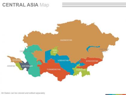 Maps of the central asia region continent countries in powerpoint
Presenting maps of the central asia region continent countries in powerpoint. This is a maps of the central asia region continent countries in powerpoint. The stages in this process are kazakhstan, uzbekistan, turkmenistan, tajikistan, armenia, caspian sea, georgia, uzbekistan.
-
 Maps in powerpoint showing caribbean region countries
Presenting maps in powerpoint showing caribbean region countries. This is a maps in powerpoint showing caribbean region countries. The stages in this process are florida usa, cayman islands, jamaica, aruba, costa rica, nicaragua, puerto rico.
-
 Maps of middle east region continent countries in powerpoint
They have an infinite angle based map PPT designs, they are also steep natured PowerPoint graphics. These are also handy for the geographical studies, researchers, anthropologists etc. They can be Rewrite able contents, symbols, formats and PowerPoint Image etc. These are fully factual with plenty of room to recover the already provided dummy statistics.The stages in this process are turkey, syria, territories, egypt, qatar, oman, yemen.
-
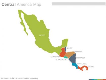 Maps of central american america region countries in powerpoint
Presenting maps of central american america region countries in powerpoint. This is a maps of central american america region countries in powerpoint. The stages in this process are mexico, guatemala, el salvador, belize, honduras, nicaragua, costa rica, panama.
-
 Maps of north america continent region countries in powerpoint
Specially enhanced PowerPoint templates, Exceptional vector based map PPT designs, Reorganize able shades, region, layouts, text, fonts size, PPT images etc, Vector based formats, Fully redesign able Presentation graphics with elasticity to insert data , Appropriate for social science students, researchers ,anthropologists etc., Convertible to PDF or JPG formats, Screen layout can be changed with click on Google slides.The stages in this process are arctic ocean, alaska, pacific ocean, canada, united states of america, central america, mexico, atlantic ocean.
-
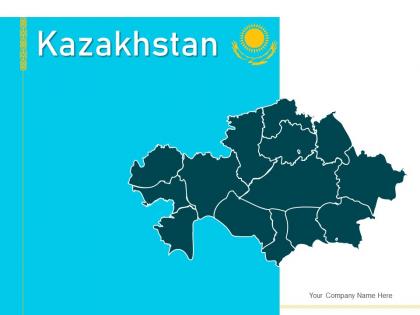 Kazakhstan map geographical locations regions currency notes
Engage buyer personas and boost brand awareness by pitching yourself using this prefabricated set. This Kazakhstan Map Geographical Locations Regions Currency Notes is a great tool to connect with your audience as it contains high-quality content and graphics. This helps in conveying your thoughts in a well-structured manner. It also helps you attain a competitive advantage because of its unique design and aesthetics. In addition to this, you can use this PPT design to portray information and educate your audience on various topics. With twelve slides, this is a great design to use for your upcoming presentations. Not only is it cost-effective but also easily pliable depending on your needs and requirements. As such color, font, or any other design component can be altered. It is also available for immediate download in different formats such as PNG, JPG, etc. So, without any further ado, download it now.
-
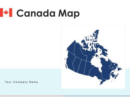 Canada map regions states digital interconnected map survey
Deliver a credible and compelling presentation by deploying this Canada Map Regions States Digital Interconnected Map Survey. Intensify your message with the right graphics, images, icons, etc. presented in this complete deck. This PPT template is a great starting point to convey your messages and build a good collaboration. The twelve slides added to this PowerPoint slideshow helps you present a thorough explanation of the topic. You can use it to study and present various kinds of information in the form of stats, figures, data charts, and many more. This Canada Map Regions States Digital Interconnected Map Survey PPT slideshow is available for use in standard and widescreen aspects ratios. So, you can use it as per your convenience. Apart from this, it can be downloaded in PNG, JPG, and PDF formats, all completely editable and modifiable. The most profound feature of this PPT design is that it is fully compatible with Google Slides making it suitable for every industry and business domain.
-
 Map of caribbean key regions political map email
Engage buyer personas and boost brand awareness by pitching yourself using this prefabricated set. This Map Of Caribbean Key Regions Political Map Email is a great tool to connect with your audience as it contains high-quality content and graphics. This helps in conveying your thoughts in a well-structured manner. It also helps you attain a competitive advantage because of its unique design and aesthetics. In addition to this, you can use this PPT design to portray information and educate your audience on various topics. With ten slides, this is a great design to use for your upcoming presentations. Not only is it cost-effective but also easily pliable depending on your needs and requirements. As such color, font, or any other design component can be altered. It is also available for immediate download in different formats such as PNG, JPG, etc. So, without any further ado, download it now.
-
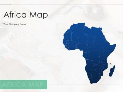 Africa map highlighting major regions countries border division
Introduce your topic and host expert discussion sessions with this Africa Map Highlighting Major Regions Countries Border Division. This template is designed using high-quality visuals, images, graphics, etc, that can be used to showcase your expertise. Different topics can be tackled using the ten slides included in this template. You can present each topic on a different slide to help your audience interpret the information more effectively. Apart from this, this PPT slideshow is available in two screen sizes, standard and widescreen making its delivery more impactful. This will not only help in presenting a birds-eye view of the topic but also keep your audience engaged. Since this PPT slideshow utilizes well-researched content, it induces strategic thinking and helps you convey your message in the best possible manner. The biggest feature of this design is that it comes with a host of editable features like color, font, background, etc. So, grab it now to deliver a unique presentation every time.
-
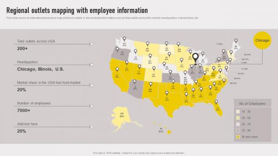 Cross Border Approach Regional Outlets Mapping With Employee Information Strategy SS V
This slide covers an international presence map of all food outlets.It also includes information such as total outlets across the market, headquarters, market share, etc. Introducing Cross Border Approach Regional Outlets Mapping With Employee Information Strategy SS V to increase your presentation threshold. Encompassed with One stages, this template is a great option to educate and entice your audience. Dispence information on Headquarters, Market Share, Number Of Employees using this template. Grab it now to reap its full benefits.
-
 Transnational Strategy For International Regional Outlets Mapping With Employee Strategy SS V
This slide covers an international presence map of all food outlets. It also includes information such as total outlets across the market, headquarters, market share, etc. Increase audience engagement and knowledge by dispensing information using Transnational Strategy For International Regional Outlets Mapping With Employee Strategy SS V This template helps you present information on One stages. You can also present information on Food Market, Headquarters, Market Share using this PPT design. This layout is completely editable so personaize it now to meet your audiences expectations.
-
 Transnational Strategy Regional Outlets Mapping With Employee Information Strategy SS V
This slide covers an international presence map of all food outlets. It also includes information such as total outlets across the market, headquarters, market share, etc. Introducing Transnational Strategy Regional Outlets Mapping With Employee Information Strategy SS V to increase your presentation threshold. Encompassed with one stage, this template is a great option to educate and entice your audience. Dispence information on Regional Outlets, Mapping With Employee, Information using this template. Grab it now to reap its full benefits.
-
 Map Of Denmark Bordered Regions With Name
This slide shows map of Denmark country with bordered regions like North Jutland, Central Denmark, Hovedstand, Southern Denmark and Zealand. Presenting our set of slides with Map Of Denmark Bordered Regions With Name. This exhibits information on three stages of the process. This is an easy to edit and innovatively designed PowerPoint template. So download immediately and highlight information on North Jutland, Hovedstaden.
-
 Blank Map Of Corsica Island Region
Presenting our set of slides with Blank Map Of Corsica Island Region. This exhibits information on three stages of the process. This is an easy to edit and innovatively designed PowerPoint template. So download immediately and highlight information on Corsica.
-
 France Regional Map With Eight Zones
Introducing our premium set of slides with France Regional Map With Eight Zones. Ellicudate the three stages and present information using this PPT slide. This is a completely adaptable PowerPoint template design that can be used to interpret topics like France Regional Map, Eight Zones. So download instantly and tailor it with your information.
-
 Political France Map With Regions Name
Introducing our premium set of slides with Political France Map With Regions Name. Ellicudate the three stages and present information using this PPT slide. This is a completely adaptable PowerPoint template design that can be used to interpret topics like Political France Map, Regions Name. So download instantly and tailor it with your information.
-
 Regional Outlets Mapping With Employee Information Worldwide Approach Strategy SS V
This slide covers an international presence map of all food outlets. It also includes information such as total outlets across the market, headquarters, market share, etc. Present the topic in a bit more detail with this Regional Outlets Mapping With Employee Information Worldwide Approach Strategy SS V. Use it as a tool for discussion and navigation on Headquarters, Employees. This template is free to edit as deemed fit for your organization. Therefore download it now.
-
 Regional Outlets Mapping With Employee Information Globalization Strategy To Expand Strategt SS V
This slide covers an international presence map of all food outlets. It also includes information such as total outlets across the market, headquarters, market share, etc. Increase audience engagement and knowledge by dispensing information using Regional Outlets Mapping With Employee Information Globalization Strategy To Expand Strategt SS V. This template helps you present information on one stage. You can also present information on Regional Outlets, Mapping With Employee Information using this PPT design. This layout is completely editable so personaize it now to meet your audiences expectations.
-
 Regional Outlets Mapping International Strategy To Expand Global Strategy SS V
This slide covers an international presence map of all food outlets. It also includes information such as total outlets across the market, headquarters, market share, etc. Introducing Regional Outlets Mapping International Strategy To Expand Global Strategy SS V to increase your presentation threshold. Encompassed with five stages, this template is a great option to educate and entice your audience. Dispence information on Across, Headquarters, Market, using this template. Grab it now to reap its full benefits.
-
 Map Of Asia Highlighting Various Regions
Presenting our set of slides with Map Of Asia Highlighting Various Regions. This exhibits information on four stages of the process. This is an easy to edit and innovatively designed PowerPoint template. So download immediately and highlight information on Map Of Asia, Highlighting Various Regions.
-
 Blank Map Of Georgia Country With Bordered Regions
Presenting our set of slides with Blank Map Of Georgia Country With Bordered Regions. This exhibits information on three stages of the process. This is an easy to edit and innovatively designed PowerPoint template. So download immediately and highlight information on Blank, Bordered, Regions.
-
 Map Of Georgia With Bordered Regions Names
Presenting our set of slides with Map Of Georgia With Bordered Regions Names. This exhibits information on three stages of the process. This is an easy to edit and innovatively designed PowerPoint template. So download immediately and highlight information on Regions, Georgia, Bordered.
-
 Highlighted Area Of Hokkaido Region In Japan Map
This slide shows marked area of Hokkaido region in map of Japan with name of all concerned prefectures along with surrounding areas and island Presenting our set of slides with Highlighted Area Of Hokkaido Region In Japan Map. This exhibits information on three stages of the process. This is an easy to edit and innovatively designed PowerPoint template. So download immediately and highlight information on Concerned, Area, Region.
-
 Labelled Map Of Asia Highlighting Different Regions
Presenting our set of slides with Labelled Map Of Asia Highlighting Different Regions. This exhibits information on six stages of the process. This is an easy to edit and innovatively designed PowerPoint template. So download immediately and highlight information on Central Asia, Southwest Asia, East Asia.
-
 Region Map Of Western African Countries
Presenting our set of slides with Region Map Of Western African Countries. This exhibits information on three stages of the process. This is an easy to edit and innovatively designed PowerPoint template. So download immediately and highlight information on Region Map Of Western, African Countries.
-
 Costa Calida Regions In Spain Map
This slide shows various region and areas name in Costa Calida, which is situated in coastline province of Murcia in Spain with surrounding water bodies. Presenting our set of slides with Costa Calida Regions In Spain Map. This exhibits information on four stages of the process. This is an easy to edit and innovatively designed PowerPoint template. So download immediately and highlight information on Costa Calida Regions, Spain Map.
-
 Highlighted Spanish Costas Map Regions
This slide shows marked areas of Costas, which are situated at coastal areas of Spain along with surrounding area and regions such as Murcia, Aragon, Madrid and Canary islands. Introducing our premium set of slides with Highlighted Spanish Costas Map Regions. Ellicudate the four stages and present information using this PPT slide. This is a completely adaptable PowerPoint template design that can be used to interpret topics like Highlighted Spanish, Costas Map Regions. So download instantly and tailor it with your information.
-
 Map Of Northern Spain With Regions Name
This slide shows all regions in Northern part of Spain which are Galacia, Asturias and Cantabria etc along with borders of surrounding countries and nearby water bodies. Presenting our set of slides with Map Of Northern Spain With Regions Name. This exhibits information on four stages of the process. This is an easy to edit and innovatively designed PowerPoint template. So download immediately and highlight information on Map Of Northern Spain, Regions Name.
-
 Map Of Southern Spain With Regions Name
This slide shows map of southern regions in Spain which are Costa De La Luz, Costa Del Sol, Costa Tropical and Inland Southern Spain etc. Introducing our premium set of slides with Map Of Southern Spain With Regions Name. Ellicudate the four stages and present information using this PPT slide. This is a completely adaptable PowerPoint template design that can be used to interpret topics like Map Of Southern Spain, Regions Name. So download instantly and tailor it with your information.
-
 Map Of Spain With Name Of All Regions And States
This slide shows map of Spain with bordered states name, provinces and islands such as Murcia, Aragon, Madrid and Canary islands. Introducing our premium set of slides with Map Of Spain With Name Of All Regions And States. Ellicudate the two stages and present information using this PPT slide. This is a completely adaptable PowerPoint template design that can be used to interpret topics like Map Of Spain With Name, All Regions And States. So download instantly and tailor it with your information.
-
 England Regional Map With Neighboring Uk Countries
This slide shows nine regions of England as northern, southern, eastern and western parts with surrounding UK countries which are Northern Ireland, Scotland and Wales. Introducing our premium set of slides with England Regional Map With Neighboring Uk Countries. Ellicudate the three stages and present information using this PPT slide. This is a completely adaptable PowerPoint template design that can be used to interpret topics like England Regional Map, Neighboring Uk Countries. So download instantly and tailor it with your information.
-
 Highland Map With Other Regions In Scotland
This slide shows labelled Highland area that covers an area of 25,657 km with other bordered regions in Scotland. Introducing our premium set of slides with Highland Map With Other Regions In Scotland. Ellicudate the four stages and present information using this PPT slide. This is a completely adaptable PowerPoint template design that can be used to interpret topics like Highland Map, Other Regions In Scotland. So download instantly and tailor it with your information.
-
 Highlighted Area Of Wellington Region On New Zealand Map
This slide shows marked area of Wellington city on map of New Zealand country with border of other provinces along with nearby water bdoies. Presenting our set of slides with Highlighted Area Of Wellington Region On New Zealand Map. This exhibits information on three stages of the process. This is an easy to edit and innovatively designed PowerPoint template. So download immediately and highlight information on Highlighted Area Of Wellington, Region On New Zealand Map.
-
 New Zealand Regions Map With Borders
This slide shows map of New Zealand country with name of bordered regions like Northland, Auckland, Tasman and Southland. Introducing our premium set of slides with New Zealand Regions Map With Borders. Ellicudate the three stages and present information using this PPT slide. This is a completely adaptable PowerPoint template design that can be used to interpret topics like New Zealand Regions, Map With Borders. So download instantly and tailor it with your information.
-
 North Island Regions Map Of New Zealand
This slide shows map of North Island regions with border in country of New Zealand like Northland, Auckland and Waikato etc. Presenting our set of slides with North Island Regions Map Of New Zealand. This exhibits information on three stages of the process. This is an easy to edit and innovatively designed PowerPoint template. So download immediately and highlight information on North Island Regions, Map Of New Zealand.
-
 South Island Regions Map Of New Zealand
This slide shows all regions names of South island area in map of New Zealand country like Tasman, Nelson and West coast etc. Introducing our premium set of slides with South Island Regions Map Of New Zealand. Ellicudate the three stages and present information using this PPT slide. This is a completely adaptable PowerPoint template design that can be used to interpret topics like South Island Regions, Map Of New Zealand. So download instantly and tailor it with your information.
-
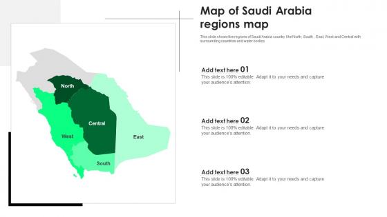 Map Of Saudi Arabia Regions Map
This slide shows five regions of Saudi Arabia country like North, South , East, West and Central with surrounding countries and water bodies Introducing our premium set of slides with Map Of Saudi Arabia Regions Map Ellicudate the three stages and present information using this PPT slide. This is a completely adaptable PowerPoint template design that can be used to interpret topics like Map, Saudi Arabia Regions Map So download instantly and tailor it with your information.
-
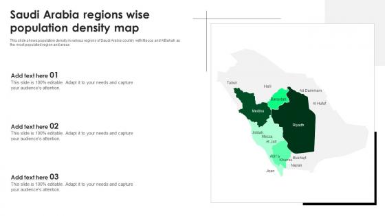 Saudi Arabia Regions Wise Population Density Map
This slide shows population density in various regions of Saudi Arabia country with Mecca and AIBahah as the most populated region and areas Presenting our set of slides with Saudi Arabia Regions Wise Population Density Map This exhibits information on three stages of the process. This is an easy to edit and innovatively designed PowerPoint template. So download immediately and highlight information on Saudi Arabia Regions Wise, Population Density Map
-
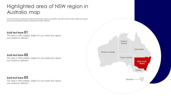 Highlighted Area Of NSW Region In Australia Map
This slide shows marked area of New South Wales region on Australia map with border of other states and region such as Queensland, Western Australia and South Australia. Presenting our set of slides with Highlighted Area Of NSW Region In Australia Map. This exhibits information on three stages of the process. This is an easy to edit and innovatively designed PowerPoint template. So download immediately and highlight information on Highlighted Area, Region In Australia Map.
-
 India Map With Name Of Six Regions And Zones
This slide shows map of India with border of all six regions and zones, which are northern, central, eastern, north eastern, western and southern regions. Presenting our set of slides with India Map With Name Of Six Regions And Zones. This exhibits information on four stages of the process. This is an easy to edit and innovatively designed PowerPoint template. So download immediately and highlight information on India Map With Name, Six Regions And Zones.
-
 Map Of Egypt With Local Administrative Region Names
Presenting our set of slides with Map Of Egypt With Local Administrative Region Names This exhibits information on three stages of the process. This is an easy to edit and innovatively designed PowerPoint template. So download immediately and highlight information on Map Of Egypt, Local Administrative Region Names
-
 Map Of Egypt With Regional Territory Names
Presenting our set of slides with Map Of Egypt With Regional Territory Names This exhibits information on four stages of the process. This is an easy to edit and innovatively designed PowerPoint template. So download immediately and highlight information on Map Of Egypt, Regional Territory Names
-
 Asia Pacific Region Map With Capitals By Country
Presenting our set of slides with Asia Pacific Region Map With Capitals By Country. This exhibits information on four stages of the process. This is an easy to edit and innovatively designed PowerPoint template. So download immediately and highlight information on Capitals By Country, Text Holders.
-
 Asia Pacific Region Map With Text Holders
Introducing our premium set of slides with Asia Pacific Region Map With Text Holders. Ellicudate the four stages and present information using this PPT slide. This is a completely adaptable PowerPoint template design that can be used to interpret topics like Capitals By Country, Text Holders. So download instantly and tailor it with your information.
-
 Blank Map Of Singapore With Regional Borders
This slide shows map of Singapore country with border of five regions and islands that constitute a total area of around 728.6 km Presenting our set of slides with Blank Map Of Singapore With Regional Borders. This exhibits information on three stages of the process. This is an easy to edit and innovatively designed PowerPoint template. So download immediately and highlight information on Singapore, Borders, Regional.
-
 Singapore Map With Five Bordered Regions
This slide shows Singapore regional map with name of five bordered regions, which are West, North, North East, East and Central etc Introducing our premium set of slides with Singapore Map With Five Bordered Regions. Ellicudate the five stages and present information using this PPT slide. This is a completely adaptable PowerPoint template design that can be used to interpret topics like Bordered, Map, Regions. So download instantly and tailor it with your information.
-
 Regional Outlets Mapping With Employee Information Global Business Strategies Strategy SS V
This slide covers an international presence map of all food outlets. It also includes information such as total outlets across the market, headquarters, market share, etc. Increase audience engagement and knowledge by dispensing information using Regional Outlets Mapping With Employee Information Global Business Strategies Strategy SS V. This template helps you present information on one stage. You can also present information on Regional Outlets Mapping, Employee Information using this PPT design. This layout is completely editable so personaize it now to meet your audiences expectations.
-
 France 13 Regions PU Maps SS
Presenting our set of slides with France 13 Regions PU Maps SS. This exhibits information on three stages of the process. This is an easy to edit and innovatively designed PowerPoint template. So download immediately and highlight information on France 13 Regions.


