Powerpoint Templates and Google slides for Countries
Save Your Time and attract your audience with our fully editable PPT Templates and Slides.
-
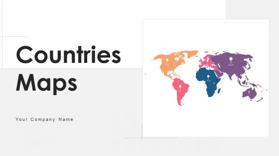 Countries Maps Powerpoint Ppt Template Bundles
If you require a professional template with great design, then this Countries Maps Powerpoint Ppt Template Bundles is an ideal fit for you. Deploy it to enthrall your audience and increase your presentation threshold with the right graphics, images, and structure. Portray your ideas and vision using one hundred seventy four slides included in this complete deck. This template is suitable for expert discussion meetings presenting your views on the topic. With a variety of slides having the same thematic representation, this template can be regarded as a complete package. It employs some of the best design practices, so everything is well-structured. Not only this, it responds to all your needs and requirements by quickly adapting itself to the changes you make. This PPT slideshow is available for immediate download in PNG, JPG, and PDF formats, further enhancing its usability. Grab it by clicking the download button.
-
 Singapore country and states map powerpoint template
Presenting our Singapore country and states map PowerPoint template. This PPT layout holds a total of one hundred and thirteen slides and each slide is accessible in standard as well as wide-screen formats. It is completely editable as per your requirements and preferences as well. You can use it with Microsoft Office, Google slides, and many other presentation software.
-
 Usa country and states map powerpoint template
Presenting USA Country And States Map Powerpoint Template. This PPT can be downloaded into formats like PDF, JPG, and PNG with ease. It is adaptable with Google Slides which makes it accessible at once. This slideshow is available in both the standard and widescreen aspect ratios. High-quality graphics ensures that there is no room for deterioration.
-
 Turkey maps country and state powerpoint template
Presenting our Turkey country and states map PowerPoint template. This PPT layout holds a total of eighty-four slides and each slide is accessible in standard as well as wide-screen formats. It is completely editable as per your requirements and preferences as well. You can use it with Microsoft Office, Google slides, and many other presentation software.
-
 Turkey country and state maps powerpoint template
This is a Turkey Country And State Maps Powerpoint Template. Showcase the emerging economical parameters of your country using this PowerPoint complete deck. This is a comprehensive set with a visually-appealing aesthetic design that will indisputably increase audience engagement. Use it to highlight the major landmarks of your country, its traditional features, and demographics with eighty three slides included in this set. You can also use the maps, charts, graphs, themes, and other components of this deck to bring more attention to the country dynamics, making it popular worldwide. Considering the information presented and showcased, this PowerPoint template can be used for the global expansion of your operations, with vivid colors, graphics, and visuals. This PPT template can be reproduced in PDF, PNG, and JPG formats, thus giving you a high level of control over its application and usage.
-
 Europe Maps Powerpoint PPT Template Bundles PU Maps
Deliver a lucid presentation by utilizing this Europe Maps Powerpoint PPT Template Bundles PU Maps. Use it to present an overview of the topic with the right visuals, themes, shapes, and graphics. This is an expertly designed complete deck that reinforces positive thoughts and actions. Use it to provide visual cues to your audience and help them make informed decisions. A wide variety of discussion topics can be covered with this creative bundle such as sixty seven. All the sixty seven slides are available for immediate download and use. They can be edited and modified to add a personal touch to the presentation. This helps in creating a unique presentation every time. Not only that, with a host of editable features, this presentation can be used by any industry or business vertical depending on their needs and requirements. The compatibility with Google Slides is another feature to look out for in the PPT slideshow.
-
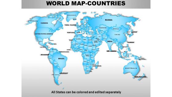 World continents powerpoint maps
Presenting world continents PowerPoint maps slide. This presentation diagram has been designed by professionals and its layout is fully customizable. You can convert the font type, font size, colors of the diagram, and background color as per your requirement. Easy to put in company logo, trademark or name; accommodate words to support the key points. Replace the dummy content in text placeholders with your presentation content. The slide is fully compatible with Google slides and can be saved in JPG or PDF format without any hassle. High quality graphics and icons ensure that there is no deterioration in quality.
-
 Uk england country powerpoint maps
These high quality, editable powerpoint state maps have been carefully created by our professional team to display location and other geographic details in your PowerPoint presentation. Each map is vector based and is 100% editable in powerpoint. Each and every property of any region - color, size, shading etc can be modified to help you build an effective powerpoint presentation. Use these maps to show sales territories, business and new office locations, travel planning etc in your presentations. Any text can be entered at any point in the powerpoint map slide. Simply DOWNLOAD, TYPE and PRESENT!
-
 Usa country powerpoint maps
Skillfully designed USA country PowerPoint map suitable for professionals from diverse sectors i.e. scholars, teachers, business professionals, researchers, etc. Personalize it with brand name and logo of your own. Enough space available to put dummy content. Manually editable presentation graphics, text, font, colors, layout, region and shading. Use these maps to show sales territories, business and new office locations, travel planning etc. in your presentations. Well adaptable with all the software’s and Google slides. High resolution PowerPoint template theme. Simply click to add logo, trademark or name. Flexibility to convert in PDF or JPG form.
-
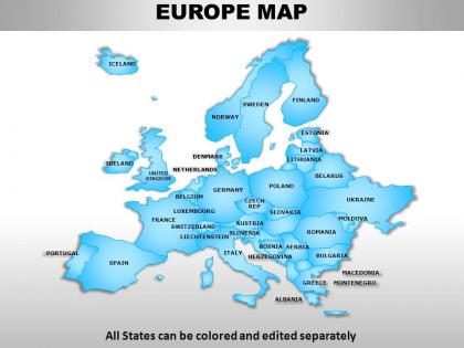 Europe continents powerpoint maps
These high quality, editable powerpoint country maps have been carefully created by our professional team to display location and other geographic details in your PowerPoint presentation. Each map is vector based and is 100% editable in powerpoint. Each and every property of any region - color, size, shading etc can be modified to help you build an effective powerpoint presentation. Use these maps to show sales territories, business and new office locations, travel planning etc in your presentations. Any text can be entered at any point in the powerpoint map slide. Simply DOWNLOAD, TYPE and PRESENT!
-
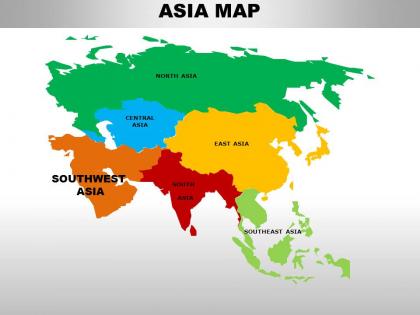 South asia continents powerpoint maps
These high quality, editable powerpoint country maps have been carefully created by our professional team to display location and other geographic details in your PowerPoint presentation. Each map is vector based and is 100% editable in powerpoint. Each and every property of any region - color, size, shading etc can be modified to help you build an effective powerpoint presentation. Use these maps to show sales territories, business and new office locations, travel planning etc in your presentations. Any text can be entered at any point in the powerpoint map slide. Simply DOWNLOAD, TYPE and PRESENT!
-
 Canada country powerpoint maps
These high quality, editable powerpoint state maps have been carefully created by our professional team to display location and other geographic details in your PowerPoint presentation. Each map is vector based and is 100% editable in powerpoint. Each and every property of any region - color, size, shading etc can be modified to help you build an effective powerpoint presentation. Use these maps to show sales territories, business and new office locations, travel planning etc in your presentations. Any text can be entered at any point in the powerpoint map slide. Simply DOWNLOAD, TYPE and PRESENT!
-
 Uk scotland country powerpoint maps
User friendly and highly organised PPT templates. Customization of Presentation graphics and diagrams according to desire and need. Fit into widescreen. Effortless conversion into PDF/ JPG format. Personalisation by insertion of company name, trademark or logo. Compatible with Google slides. Beneficial for multinational firms, diverse companies, travel planning, sales management, professors, teachers, students.
-
 Uk wales country powerpoint maps
These high quality, editable powerpoint state maps have been carefully created by our professional team to display location and other geographic details in your PowerPoint presentation. Each map is vector based and is 100% editable in powerpoint. Each and every property of any region - color, size, shading etc can be modified to help you build an effective powerpoint presentation. Use these maps to show sales territories, business and new office locations, travel planning etc in your presentations. Any text can be entered at any point in the powerpoint map slide. Simply DOWNLOAD, TYPE and PRESENT!
-
 Middle east asia continents powerpoint maps
These high quality, editable powerpoint country maps have been carefully created by our professional team to display location and other geographic details in your PowerPoint presentation. Each map is vector based and is 100% editable in powerpoint. Each and every property of any region - color, size, shading etc can be modified to help you build an effective powerpoint presentation. Use these maps to show sales territories, business and new office locations, travel planning etc in your presentations. Any text can be entered at any point in the powerpoint map slide. Simply DOWNLOAD, TYPE and PRESENT!
-
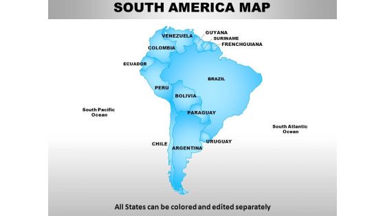 South america continents powerpoint maps
PowerPoint slide can be edited into JPEG and PDF. Alternate to adjust the PPT diagram as per the desire. Pixels don’t break even when you share in widescreen display. Presentation template functions well with Google slides. Superlative quality images and graphics are used in the PPT graphic. Download comes with different nodes and stages. Easy to amend and add business credentials such as logo, name and other elements that you want to add.
-
 Australia continents powerpoint maps with act territory
We are proud to present our australia continents powerpoint maps with act territory. Our Australia Continents PowerPoint Maps with ACT Territory Power Point Templates Are Topically Designed To Provide An Attractive Backdrop To Any Subject. Use Them To Look Like A Presentation Pro. Use Our Australia Continents PowerPoint Maps with ACT Territory Power Point Templates To Effectively Help You Save Your Valuable Time. They Are Readymade To Fit Into Any Presentation Structure.
-
 Uk northern ireland country powerpoint maps
These high quality, editable powerpoint state maps have been carefully created by our professional team to display location and other geographic details in your PowerPoint presentation. Each map is vector based and is 100% editable in powerpoint. Each and every property of any region - color, size, shading etc can be modified to help you build an effective powerpoint presentation. Use these maps to show sales territories, business and new office locations, travel planning etc in your presentations. Any text can be entered at any point in the powerpoint map slide. Simply DOWNLOAD, TYPE and PRESENT!
-
 Africa continents powerpoint maps
We present to you our Africa Continents PowerPoint maps. You can save this slideshow in PDF or JPG format conveniently. After you download this presentation, it can be viewed in standard size display ratio of 4:3 or widescreen display ratio of 16:9. This maps PPT is fully editable so you can easily add or delete any given feature or the text used in the pre- designed slideshow. This Maps PPT template is Google Slides friendly which makes it very easy to use.
-
 Australia continents powerpoint maps
These high quality, editable powerpoint country maps have been carefully created by our professional team to display location and other geographic details in your PowerPoint presentation. Each map is vector based and is 100% editable in powerpoint. Each and every property of any region - color, size, shading etc can be modified to help you build an effective powerpoint presentation. Use these maps to show sales territories, business and new office locations, travel planning etc in your presentations. Any text can be entered at any point in the powerpoint map slide. Simply DOWNLOAD, TYPE and PRESENT!
-
 Mexico country powerpoint maps
These high quality, editable powerpoint state maps have been carefully created by our professional team to display location and other geographic details in your PowerPoint presentation. Each map is vector based and is 100% editable in powerpoint. Each and every property of any region - color, size, shading etc can be modified to help you build an effective powerpoint presentation. Use these maps to show sales territories, business and new office locations, travel planning etc in your presentations. Any text can be entered at any point in the powerpoint map slide. Simply DOWNLOAD, TYPE and PRESENT!
-
 Central asia continents powerpoint maps
These high quality, editable powerpoint country maps have been carefully created by our professional team to display location and other geographic details in your PowerPoint presentation. Each map is vector based and is 100% editable in powerpoint. Each and every property of any region - color, size, shading etc can be modified to help you build an effective powerpoint presentation. Use these maps to show sales territories, business and new office locations, travel planning etc in your presentations. Any text can be entered at any point in the powerpoint map slide. Simply DOWNLOAD, TYPE and PRESENT!
-
 South east asia continents powerpoint maps
These high quality, editable powerpoint country maps have been carefully created by our professional team to display location and other geographic details in your PowerPoint presentation. Each map is vector based and is 100% editable in powerpoint. Each and every property of any region - color, size, shading etc can be modified to help you build an effective powerpoint presentation. Use these maps to show sales territories, business and new office locations, travel planning etc in your presentations. Any text can be entered at any point in the powerpoint map slide. Simply DOWNLOAD, TYPE and PRESENT!
-
 East asia continents powerpoint maps
These high quality, editable powerpoint country maps have been carefully created by our professional team to display location and other geographic details in your PowerPoint presentation. Each map is vector based and is 100% editable in powerpoint. Each and every property of any region - color, size, shading etc can be modified to help you build an effective powerpoint presentation. Use these maps to show sales territories, business and new office locations, travel planning etc in your presentations. Any text can be entered at any point in the powerpoint map slide. Simply DOWNLOAD, TYPE and PRESENT!
-
 Guide To Introduce New Product Portfolio In The Target Region Powerpoint Presentation Slides
This complete deck covers various topics and highlights important concepts. It has PPT slides which cater to your business needs. This complete deck presentation emphasizes Guide To Introduce New Product Portfolio In The Target Region Powerpoint Presentation Slides and has templates with professional background images and relevant content. This deck consists of total of fifty slides. Our designers have created customizable templates, keeping your convenience in mind. You can edit the color, text and font size with ease. Not just this, you can also add or delete the content if needed. Get access to this fully editable complete presentation by clicking the download button below.
-
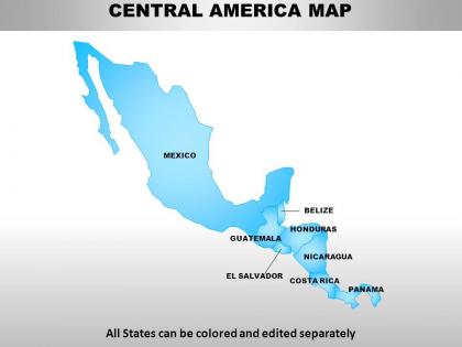 Central america continents powerpoint maps
Presenting Central America continents PowerPoint maps. Available both in standard and widescreen view. Easy to modify into JPEG or PDF document. Editable PowerPoint template designs to meet the industry requirements. Downloadable PPT design to insert data and share. Available in high quality resolution display. Useful for industry professionals, teachers, lawyers, students, strategists and management planners. Fully compatible with Google slides. Easy to download and saves valuable time and effort. Compatible with number of software options.
-
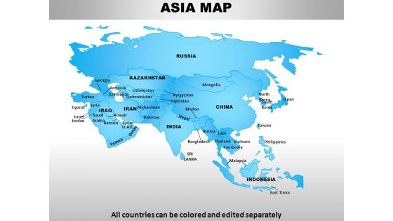 Asia continents powerpoint maps
Presenting Asia Continents PowerPoint maps complete PowerPoint presentation with editable PPT slides. All slides are professionally designed by our team of PowerPoint designers. The presentation content covers all areas of Asia maps and is extensively researched. This ready-to-use deck comprises visually stunning PowerPoint templates, designs and maps. The deck consists of a total of 52 slides. You can customize this presentation as per your branding needs. You can change the font size, font type, colors as per your requirement. Download the presentation, enter your content in the placeholders and present with confidence!
-
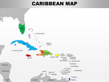 0714 caribbean region powerpoint maps showing bahamas haiti etc
Use of high-resolution, pixel friendly graphics in the slide design. Access to customize the entire ribbon of the slide icon. Allow to adjust the aspect ratio or the cropping of images. Offer insertion of elements from online platforms. Enjoy removing background and redesigning it. Functional for the business managers, marketing people, developers and relevant employees.
-
 North america continents powerpoint maps
Useful for teachers, professors, businessmen, professionals in for-profit and nonprofit organization, tourism industry and many more. Conversion of slides to JPG and PDF formats an option. View slides in widescreen for different screens. PPT model slides compatible with google slides for effortless viewing. Great PowerPoint graphics with option to change features like shape, size and color of the icon/object.
-
 Introducing mobile financial services in developing countries powerpoint presentation slides
Deliver this complete deck to your team members and other collaborators. Encompassed with stylized slides presenting various concepts, this Introducing Mobile Financial Services In Developing Countries Powerpoint Powerpoint Presentation is the best tool you can utilize. Personalize its content and graphics to make it unique and thought-provoking. All the fourty seven slides are editable and modifiable, so feel free to adjust them to your business setting. The font, color, and other components also come in an editable format making this PPT design the best choice for your next presentation. So, download now.
-
 Marketing as a regional development approach powerpoint presentation slides
Deliver this complete deck to your team members and other collaborators. Encompassed with stylized slides presenting various concepts, this Marketing As A Regional Development Approach Powerpoint Presentation Slides is the best tool you can utilize. Personalize its content and graphics to make it unique and thought provoking. All the fourty six slides are editable and modifiable, so feel free to adjust them to your business setting. The font, color, and other components also come in an editable format making this PPT design the best choice for your next presentation. So, download now.
-
 Overview of regional marketing plan powerpoint presentation slides
Presenting our overview of regional marketing plan PowerPoint presentation slides. This PowerPoint design contains forty five slides in it which can be completely customized and edited. It is available for both standard as well as for widescreen formats. This PowerPoint template is compatible with all the presentation software like Microsoft Office, Google Slides, etc. It can be downloaded in varying formats like JPEG, PDF, PNG, etc. You can download this PPT layout from below.
-
 Region market analysis powerpoint presentation slides
Deliver an informational PPT on various topics by using this Region Market Analysis Powerpoint Presentation Slides. This deck focuses and implements best industry practices, thus providing a birds eye view of the topic. Encompassed with fourty one slides, designed using high quality visuals and graphics, this deck is a complete package to use and download. All the slides offered in this deck are subjective to innumerable alterations, thus making you a pro at delivering and educating. You can modify the color of the graphics, background, or anything else as per your needs and requirements. It suits every business vertical because of its adaptable layout.
-
 Germany country and sates map powerpoint template
Presenting our Germany country and states map PowerPoint template. This PPT layout holds a total of thirty-five slides and each slide is accessible in standard as well as wide-screen formats. It is completely editable as per your requirements and preferences as well. You can use it with Microsoft Office, Google slides, and many other presentation software.
-
 Regional Water Rendering Project Proposal Example Document Report Doc Pdf Ppt
This is a complete deck titled Regional Water Rendering Project Proposal Example Document Report Doc Pdf Ppt. It is crafted using high-quality visuals that can be readjusted in PowerPoint and Google Slides. This template comes in an editable format and is available in A4 size format for immediate download.
-
 Usa midwest region country powerpoint maps
These high quality, editable powerpoint state maps have been carefully created by our professional team to display location and other geographic details in your PowerPoint presentation. Each map is vector based and is 100% editable in powerpoint. Each and every property of any region - color, size, shading etc can be modified to help you build an effective powerpoint presentation. Use these maps to show sales territories, business and new office locations, travel planning etc in your presentations. Any text can be entered at any point in the powerpoint map slide. Simply DOWNLOAD, TYPE and PRESENT!
-
 Usa northeast region country powerpoint maps
These high quality, editable powerpoint state maps have been carefully created by our professional team to display location and other geographic details in your PowerPoint presentation. Each map is vector based and is 100% editable in powerpoint. Each and every property of any region - color, size, shading etc can be modified to help you build an effective powerpoint presentation. Use these maps to show sales territories, business and new office locations, travel planning etc in your presentations. Any text can be entered at any point in the powerpoint map slide. Simply DOWNLOAD, TYPE and PRESENT!
-
 Usa rocky mountain region country powerpoint maps
These high quality, editable powerpoint state maps have been carefully created by our professional team to display location and other geographic details in your PowerPoint presentation. Each map is vector based and is 100% editable in powerpoint. Each and every property of any region - color, size, shading etc can be modified to help you build an effective powerpoint presentation. Use these maps to show sales territories, business and new office locations, travel planning etc in your presentations. Any text can be entered at any point in the powerpoint map slide. Simply DOWNLOAD, TYPE and PRESENT!
-
 Usa south region country powerpoint maps
These high quality, editable powerpoint state maps have been carefully created by our professional team to display location and other geographic details in your PowerPoint presentation. Each map is vector based and is 100% editable in powerpoint. Each and every property of any region - color, size, shading etc can be modified to help you build an effective powerpoint presentation. Use these maps to show sales territories, business and new office locations, travel planning etc in your presentations. Any text can be entered at any point in the powerpoint map slide. Simply DOWNLOAD, TYPE and PRESENT!
-
 Usa pacific region country powerpoint maps
These high quality, editable powerpoint state maps have been carefully created by our professional team to display location and other geographic details in your PowerPoint presentation. Each map is vector based and is 100% editable in powerpoint. Each and every property of any region - color, size, shading etc can be modified to help you build an effective powerpoint presentation. Use these maps to show sales territories, business and new office locations, travel planning etc in your presentations. Any text can be entered at any point in the powerpoint map slide. Simply DOWNLOAD, TYPE and PRESENT!
-
 France country and states map powerpoint template
Presenting our France country and states map PowerPoint template. This PPT layout holds a total of twenty-nine slides and each slide is accessible in standard as well as wide-screen formats. It is completely editable as per your requirements and preferences as well. You can use it with Microsoft Office, Google slides, and many other presentation software.
-
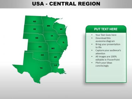 Usa central region country powerpoint maps
These high quality, editable powerpoint state maps have been carefully created by our professional team to display location and other geographic details in your PowerPoint presentation. Each map is vector based and is 100% editable in powerpoint. Each and every property of any region - color, size, shading etc can be modified to help you build an effective powerpoint presentation. Use these maps to show sales territories, business and new office locations, travel planning etc in your presentations. Any text can be entered at any point in the powerpoint map slide. Simply DOWNLOAD, TYPE and PRESENT!
-
 Usa eastern region country powerpoint maps
These high quality, editable powerpoint state maps have been carefully created by our professional team to display location and other geographic details in your PowerPoint presentation. Each map is vector based and is 100% editable in powerpoint. Each and every property of any region - color, size, shading etc can be modified to help you build an effective powerpoint presentation. Use these maps to show sales territories, business and new office locations, travel planning etc in your presentations. Any text can be entered at any point in the powerpoint map slide. Simply DOWNLOAD, TYPE and PRESENT!
-
 Usa mountain region country powerpoint maps
These high quality, editable powerpoint state maps have been carefully created by our professional team to display location and other geographic details in your PowerPoint presentation. Each map is vector based and is 100% editable in powerpoint. Each and every property of any region - color, size, shading etc can be modified to help you build an effective powerpoint presentation. Use these maps to show sales territories, business and new office locations, travel planning etc in your presentations. Any text can be entered at any point in the powerpoint map slide. Simply DOWNLOAD, TYPE and PRESENT!
-
 Usa south west region country powerpoint maps
These high quality, editable powerpoint state maps have been carefully created by our professional team to display location and other geographic details in your PowerPoint presentation. Each map is vector based and is 100% editable in powerpoint. Each and every property of any region - color, size, shading etc can be modified to help you build an effective powerpoint presentation. Use these maps to show sales territories, business and new office locations, travel planning etc in your presentations. Any text can be entered at any point in the powerpoint map slide. Simply DOWNLOAD, TYPE and PRESENT!
-
 Usa western region country powerpoint maps
These high quality, editable powerpoint state maps have been carefully created by our professional team to display location and other geographic details in your PowerPoint presentation. Each map is vector based and is 100% editable in powerpoint. Each and every property of any region - color, size, shading etc can be modified to help you build an effective powerpoint presentation. Use these maps to show sales territories, business and new office locations, travel planning etc in your presentations. Any text can be entered at any point in the powerpoint map slide. Simply DOWNLOAD, TYPE and PRESENT!
-
 European union continents powerpoint maps
User friendly and highly organised PPT templates. Customization of Presentation graphics and diagrams according to desire and need. Fit into widescreen. Effortless conversion into PDF/ JPG format. Personalisation by insertion of company name, trademark or logo. Compatible with Google slides. Beneficial for multinational firms, diverse companies, travel planning, sales management, professors, teachers, students.
-
 Regional Water Supply Extension Project Proposal Sample Document Report Doc Pdf Ppt
This is Regional Water Supply Extension Project Proposal Sample Document Report Doc Pdf Ppt featuring A4 size content and graphics. It is designed in PowerPoint using various tools. However, you can also access it with Google Slides.
-
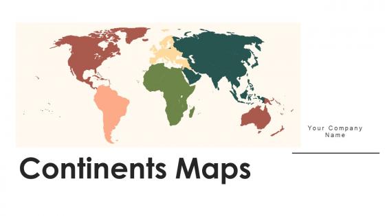 Continents Maps Powerpoint Ppt Template Bundles PU Maps
Deliver a lucid presentation by utilizing this Continents Maps Powerpoint Ppt Template Bundles PU Maps. Use it to present an overview of the topic with the right visuals, themes, shapes, and graphics. This is an expertly designed complete deck that reinforces positive thoughts and actions. Use it to provide visual cues to your audience and help them make informed decisions. A wide variety of discussion topics can be covered with this creative bundle such as seventeen. All the seventeen slides are available for immediate download and use. They can be edited and modified to add a personal touch to the presentation. This helps in creating a unique presentation every time. Not only that, with a host of editable features, this presentation can be used by any industry or business vertical depending on their needs and requirements. The compatibility with Google Slides is another feature to look out for in the PPT slideshow.
-
 Maps of south eastern asia region continent countries in powerpoint
Following PPT slide can be used for business and marketing presentations by professionals from a diverse business background for displaying locations. After downloading this PowerPoint template you can explore the full version of the slides, which allows you to resize the map and fill countries in different colors and use location icon to portray your business location. The stages in this process are vietnam, brunei, indonesia, brunei, philippines, east timor, thailand.
-
 Maps of the europe european continent countries in powerpoint
Use this PPT slide for strategy map and displaying business locations and geographical details in Europe through a PowerPoint presentations. You can download this enticing PPT template and take advantage of the full version of this slide which includes editing the text, changing the colors according to your liking, watermark gets removed, insert your company's logo and get slides in widescreen.The stages in this process are iceland, denmark, germany, france, spain, poland, slovakia.
-
 Maps of south america continent countries in powerpoint
The following map is a representation of a PPT slide which can be used for laying down your business location and geographical details in countries of south America and can be used by professionals for their PowerPoint presentations. You can alter the size of the map used in the image and also use location icons. Experience these Ppt slides in the full screen version after downloading. The stages in this process are south pacific ocean, ecuador, bolivia, argentina, brazil, uruguay, argentina.
-
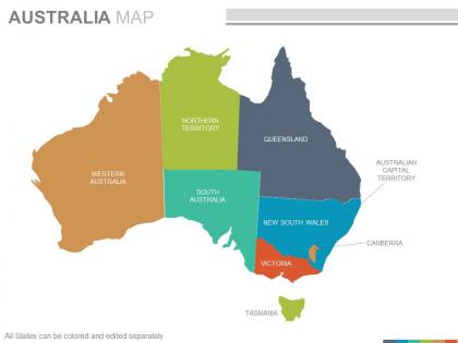 Maps of the australian australia continent countries in powerpoint
Presenting maps of the australian australia continent countries in powerpoint. This is a maps of the australian australia continent countries in powerpoint. The stages in this process are western australia, northern territory, south australia, queensland, new south wales, victoria, australian capital territory, canberra.
-
 Maps of the asian asia continent countries in powerpoint
This PPT Template can be used by Professionals from a diverse background for displaying their business location and corporate communication in Asia Continent. The maps used on this slide are all vector based and can be edited in a Powerpoint software, you can edit the text area and include it wherever you want on the slide. The stages in this process are kazakhstan, india, bahrain, pakistan, china, bangladesh, japan, malaysia.
-
 Maps of the african africa continent countries in powerpoint
These are absolutely progressive PowerPoint visuals providing an eternal experience to the viewers. These are trajectory placed PPT layouts, designs, shapes, maps, shades and figures etc. These PPT graphics can be congruent with Google slides and other operating programs. This PPT design provides enough storage space, These Presentation templates can also be easily exportable in to various setups. The stages in this process are morocco, niger, sudan, ethiopla, eritrea, comoros, angola.
-
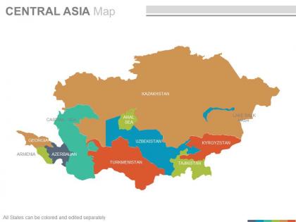 Maps of the central asia region continent countries in powerpoint
Presenting maps of the central asia region continent countries in powerpoint. This is a maps of the central asia region continent countries in powerpoint. The stages in this process are kazakhstan, uzbekistan, turkmenistan, tajikistan, armenia, caspian sea, georgia, uzbekistan.
-
 Maps in powerpoint showing caribbean region countries
Presenting maps in powerpoint showing caribbean region countries. This is a maps in powerpoint showing caribbean region countries. The stages in this process are florida usa, cayman islands, jamaica, aruba, costa rica, nicaragua, puerto rico.
-
 Maps of middle east region continent countries in powerpoint
They have an infinite angle based map PPT designs, they are also steep natured PowerPoint graphics. These are also handy for the geographical studies, researchers, anthropologists etc. They can be Rewrite able contents, symbols, formats and PowerPoint Image etc. These are fully factual with plenty of room to recover the already provided dummy statistics.The stages in this process are turkey, syria, territories, egypt, qatar, oman, yemen.
-
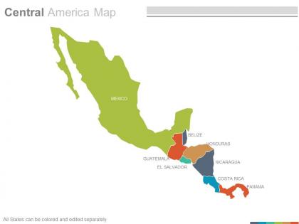 Maps of central american america region countries in powerpoint
Presenting maps of central american america region countries in powerpoint. This is a maps of central american america region countries in powerpoint. The stages in this process are mexico, guatemala, el salvador, belize, honduras, nicaragua, costa rica, panama.
-
 India country powerpoint maps
Presenting india country powerpoint maps. These high quality, editable powerpoint state maps have been carefully created by our professional team to display location and other geographic details in your PowerPoint presentation. Each map is vector based and is 100 percent editable in powerpoint. Each and every property of any region - color, size, shading etc can be modified to help you build an effective powerpoint presentation. Use these maps to show sales territories, business and new office locations, travel planning etc in your presentations. Any text can be entered at any point in the powerpoint map slide. Simply DOWNLOAD, TYPE and PRESENT.


