Powerpoint Templates and Google slides for Continental
Save Your Time and attract your audience with our fully editable PPT Templates and Slides.
-
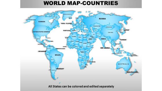 World continents powerpoint maps
Presenting world continents PowerPoint maps slide. This presentation diagram has been designed by professionals and its layout is fully customizable. You can convert the font type, font size, colors of the diagram, and background color as per your requirement. Easy to put in company logo, trademark or name; accommodate words to support the key points. Replace the dummy content in text placeholders with your presentation content. The slide is fully compatible with Google slides and can be saved in JPG or PDF format without any hassle. High quality graphics and icons ensure that there is no deterioration in quality.
-
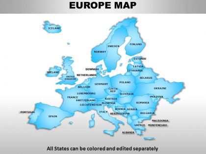 Europe continents powerpoint maps
These high quality, editable powerpoint country maps have been carefully created by our professional team to display location and other geographic details in your PowerPoint presentation. Each map is vector based and is 100% editable in powerpoint. Each and every property of any region - color, size, shading etc can be modified to help you build an effective powerpoint presentation. Use these maps to show sales territories, business and new office locations, travel planning etc in your presentations. Any text can be entered at any point in the powerpoint map slide. Simply DOWNLOAD, TYPE and PRESENT!
-
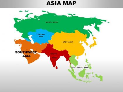 South asia continents powerpoint maps
These high quality, editable powerpoint country maps have been carefully created by our professional team to display location and other geographic details in your PowerPoint presentation. Each map is vector based and is 100% editable in powerpoint. Each and every property of any region - color, size, shading etc can be modified to help you build an effective powerpoint presentation. Use these maps to show sales territories, business and new office locations, travel planning etc in your presentations. Any text can be entered at any point in the powerpoint map slide. Simply DOWNLOAD, TYPE and PRESENT!
-
 Middle east asia continents powerpoint maps
These high quality, editable powerpoint country maps have been carefully created by our professional team to display location and other geographic details in your PowerPoint presentation. Each map is vector based and is 100% editable in powerpoint. Each and every property of any region - color, size, shading etc can be modified to help you build an effective powerpoint presentation. Use these maps to show sales territories, business and new office locations, travel planning etc in your presentations. Any text can be entered at any point in the powerpoint map slide. Simply DOWNLOAD, TYPE and PRESENT!
-
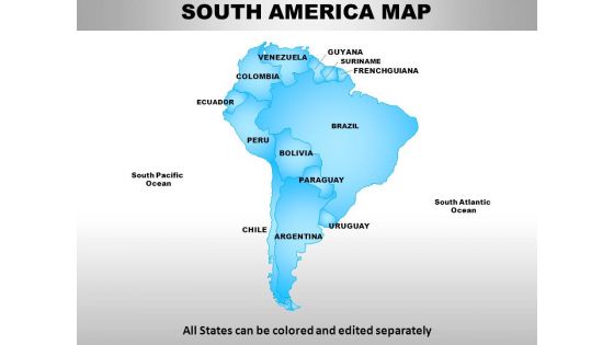 South america continents powerpoint maps
PowerPoint slide can be edited into JPEG and PDF. Alternate to adjust the PPT diagram as per the desire. Pixels don’t break even when you share in widescreen display. Presentation template functions well with Google slides. Superlative quality images and graphics are used in the PPT graphic. Download comes with different nodes and stages. Easy to amend and add business credentials such as logo, name and other elements that you want to add.
-
 Australia continents powerpoint maps with act territory
We are proud to present our australia continents powerpoint maps with act territory. Our Australia Continents PowerPoint Maps with ACT Territory Power Point Templates Are Topically Designed To Provide An Attractive Backdrop To Any Subject. Use Them To Look Like A Presentation Pro. Use Our Australia Continents PowerPoint Maps with ACT Territory Power Point Templates To Effectively Help You Save Your Valuable Time. They Are Readymade To Fit Into Any Presentation Structure.
-
 Africa continents powerpoint maps
We present to you our Africa Continents PowerPoint maps. You can save this slideshow in PDF or JPG format conveniently. After you download this presentation, it can be viewed in standard size display ratio of 4:3 or widescreen display ratio of 16:9. This maps PPT is fully editable so you can easily add or delete any given feature or the text used in the pre- designed slideshow. This Maps PPT template is Google Slides friendly which makes it very easy to use.
-
 Australia continents powerpoint maps
These high quality, editable powerpoint country maps have been carefully created by our professional team to display location and other geographic details in your PowerPoint presentation. Each map is vector based and is 100% editable in powerpoint. Each and every property of any region - color, size, shading etc can be modified to help you build an effective powerpoint presentation. Use these maps to show sales territories, business and new office locations, travel planning etc in your presentations. Any text can be entered at any point in the powerpoint map slide. Simply DOWNLOAD, TYPE and PRESENT!
-
 Central asia continents powerpoint maps
These high quality, editable powerpoint country maps have been carefully created by our professional team to display location and other geographic details in your PowerPoint presentation. Each map is vector based and is 100% editable in powerpoint. Each and every property of any region - color, size, shading etc can be modified to help you build an effective powerpoint presentation. Use these maps to show sales territories, business and new office locations, travel planning etc in your presentations. Any text can be entered at any point in the powerpoint map slide. Simply DOWNLOAD, TYPE and PRESENT!
-
 South east asia continents powerpoint maps
These high quality, editable powerpoint country maps have been carefully created by our professional team to display location and other geographic details in your PowerPoint presentation. Each map is vector based and is 100% editable in powerpoint. Each and every property of any region - color, size, shading etc can be modified to help you build an effective powerpoint presentation. Use these maps to show sales territories, business and new office locations, travel planning etc in your presentations. Any text can be entered at any point in the powerpoint map slide. Simply DOWNLOAD, TYPE and PRESENT!
-
 East asia continents powerpoint maps
These high quality, editable powerpoint country maps have been carefully created by our professional team to display location and other geographic details in your PowerPoint presentation. Each map is vector based and is 100% editable in powerpoint. Each and every property of any region - color, size, shading etc can be modified to help you build an effective powerpoint presentation. Use these maps to show sales territories, business and new office locations, travel planning etc in your presentations. Any text can be entered at any point in the powerpoint map slide. Simply DOWNLOAD, TYPE and PRESENT!
-
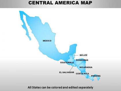 Central america continents powerpoint maps
Presenting Central America continents PowerPoint maps. Available both in standard and widescreen view. Easy to modify into JPEG or PDF document. Editable PowerPoint template designs to meet the industry requirements. Downloadable PPT design to insert data and share. Available in high quality resolution display. Useful for industry professionals, teachers, lawyers, students, strategists and management planners. Fully compatible with Google slides. Easy to download and saves valuable time and effort. Compatible with number of software options.
-
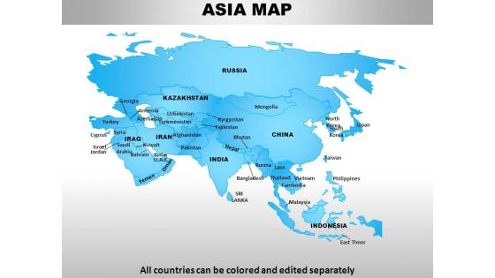 Asia continents powerpoint maps
Presenting Asia Continents PowerPoint maps complete PowerPoint presentation with editable PPT slides. All slides are professionally designed by our team of PowerPoint designers. The presentation content covers all areas of Asia maps and is extensively researched. This ready-to-use deck comprises visually stunning PowerPoint templates, designs and maps. The deck consists of a total of 52 slides. You can customize this presentation as per your branding needs. You can change the font size, font type, colors as per your requirement. Download the presentation, enter your content in the placeholders and present with confidence!
-
 North america continents powerpoint maps
Useful for teachers, professors, businessmen, professionals in for-profit and nonprofit organization, tourism industry and many more. Conversion of slides to JPG and PDF formats an option. View slides in widescreen for different screens. PPT model slides compatible with google slides for effortless viewing. Great PowerPoint graphics with option to change features like shape, size and color of the icon/object.
-
 European union continents powerpoint maps
User friendly and highly organised PPT templates. Customization of Presentation graphics and diagrams according to desire and need. Fit into widescreen. Effortless conversion into PDF/ JPG format. Personalisation by insertion of company name, trademark or logo. Compatible with Google slides. Beneficial for multinational firms, diverse companies, travel planning, sales management, professors, teachers, students.
-
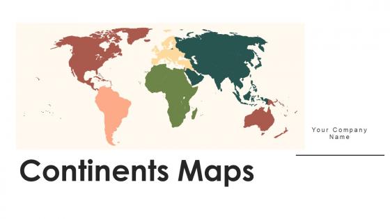 Continents Maps Powerpoint Ppt Template Bundles PU Maps
Deliver a lucid presentation by utilizing this Continents Maps Powerpoint Ppt Template Bundles PU Maps. Use it to present an overview of the topic with the right visuals, themes, shapes, and graphics. This is an expertly designed complete deck that reinforces positive thoughts and actions. Use it to provide visual cues to your audience and help them make informed decisions. A wide variety of discussion topics can be covered with this creative bundle such as seventeen. All the seventeen slides are available for immediate download and use. They can be edited and modified to add a personal touch to the presentation. This helps in creating a unique presentation every time. Not only that, with a host of editable features, this presentation can be used by any industry or business vertical depending on their needs and requirements. The compatibility with Google Slides is another feature to look out for in the PPT slideshow.
-
 Maps of south eastern asia region continent countries in powerpoint
Following PPT slide can be used for business and marketing presentations by professionals from a diverse business background for displaying locations. After downloading this PowerPoint template you can explore the full version of the slides, which allows you to resize the map and fill countries in different colors and use location icon to portray your business location. The stages in this process are vietnam, brunei, indonesia, brunei, philippines, east timor, thailand.
-
 Maps of the europe european continent countries in powerpoint
Use this PPT slide for strategy map and displaying business locations and geographical details in Europe through a PowerPoint presentations. You can download this enticing PPT template and take advantage of the full version of this slide which includes editing the text, changing the colors according to your liking, watermark gets removed, insert your company's logo and get slides in widescreen.The stages in this process are iceland, denmark, germany, france, spain, poland, slovakia.
-
 Maps of south america continent countries in powerpoint
The following map is a representation of a PPT slide which can be used for laying down your business location and geographical details in countries of south America and can be used by professionals for their PowerPoint presentations. You can alter the size of the map used in the image and also use location icons. Experience these Ppt slides in the full screen version after downloading. The stages in this process are south pacific ocean, ecuador, bolivia, argentina, brazil, uruguay, argentina.
-
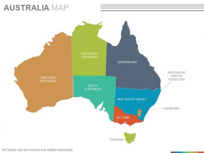 Maps of the australian australia continent countries in powerpoint
Presenting maps of the australian australia continent countries in powerpoint. This is a maps of the australian australia continent countries in powerpoint. The stages in this process are western australia, northern territory, south australia, queensland, new south wales, victoria, australian capital territory, canberra.
-
 Maps of the asian asia continent countries in powerpoint
This PPT Template can be used by Professionals from a diverse background for displaying their business location and corporate communication in Asia Continent. The maps used on this slide are all vector based and can be edited in a Powerpoint software, you can edit the text area and include it wherever you want on the slide. The stages in this process are kazakhstan, india, bahrain, pakistan, china, bangladesh, japan, malaysia.
-
 Maps of the african africa continent countries in powerpoint
These are absolutely progressive PowerPoint visuals providing an eternal experience to the viewers. These are trajectory placed PPT layouts, designs, shapes, maps, shades and figures etc. These PPT graphics can be congruent with Google slides and other operating programs. This PPT design provides enough storage space, These Presentation templates can also be easily exportable in to various setups. The stages in this process are morocco, niger, sudan, ethiopla, eritrea, comoros, angola.
-
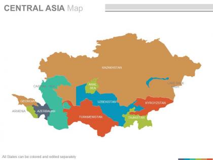 Maps of the central asia region continent countries in powerpoint
Presenting maps of the central asia region continent countries in powerpoint. This is a maps of the central asia region continent countries in powerpoint. The stages in this process are kazakhstan, uzbekistan, turkmenistan, tajikistan, armenia, caspian sea, georgia, uzbekistan.
-
 Maps of middle east region continent countries in powerpoint
They have an infinite angle based map PPT designs, they are also steep natured PowerPoint graphics. These are also handy for the geographical studies, researchers, anthropologists etc. They can be Rewrite able contents, symbols, formats and PowerPoint Image etc. These are fully factual with plenty of room to recover the already provided dummy statistics.The stages in this process are turkey, syria, territories, egypt, qatar, oman, yemen.
-
 Maps of north america continent region countries in powerpoint
Specially enhanced PowerPoint templates, Exceptional vector based map PPT designs, Reorganize able shades, region, layouts, text, fonts size, PPT images etc, Vector based formats, Fully redesign able Presentation graphics with elasticity to insert data , Appropriate for social science students, researchers ,anthropologists etc., Convertible to PDF or JPG formats, Screen layout can be changed with click on Google slides.The stages in this process are arctic ocean, alaska, pacific ocean, canada, united states of america, central america, mexico, atlantic ocean.
-
 Globes country continents outlines powerpoint slides and ppt templates db
These high quality, editable pre-designed powerpoint slides and powerpoint templates have been carefully created by our professional team to help you impress your audience. Each graphic in every powerpoint slide is vector based and is 100% editable in powerpoint.Each and every property of any slide - color, size, shading etc can be modified to build an effective powerpoint presentation. Use these slides to convey complex business concepts in a simplified manner. Any text can be entered at any point in the powerpoint slide. Simply DOWNLOAD, TYPE and PRESENT
-
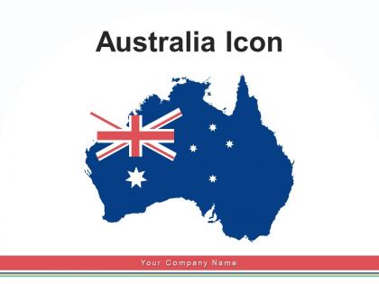 Australia Icon Political Boarders Circular National Continent Location
Deliver a lucid presentation by utilizing this Australia Icon Political Boarders Circular National Continent Location. Use it to present an overview of the topic with the right visuals, themes, shapes, and graphics. This is an expertly designed complete deck that reinforces positive thoughts and actions. Use it to provide visual cues to your audience and help them make informed decisions. A wide variety of discussion topics can be covered with this creative bundle such as Australia Icon, Political, Boarders, Circular, National. All the twelve slides are available for immediate download and use. They can be edited and modified to add a personal touch to the presentation. This helps in creating a unique presentation every time. Not only that, with a host of editable features, this presentation can be used by any industry or business vertical depending on their needs and requirements. The compatibility with Google Slides is another feature to look out for in the PPT slideshow.
-
 Europe Flag Building Continent Waving Union Stars
Deliver a credible and compelling presentation by deploying this Europe Flag Building Continent Waving Union Stars. Intensify your message with the right graphics, images, icons, etc. presented in this complete deck. This PPT template is a great starting point to convey your messages and build a good collaboration. The twelve slides added to this PowerPoint slideshow helps you present a thorough explanation of the topic. You can use it to study and present various kinds of information in the form of stats, figures, data charts, and many more. This Europe Flag Building Continent Waving Union Stars PPT slideshow is available for use in standard and widescreen aspects ratios. So, you can use it as per your convenience. Apart from this, it can be downloaded in PNG, JPG, and PDF formats, all completely editable and modifiable. The most profound feature of this PPT design is that it is fully compatible with Google Slides making it suitable for every industry and business domain.
-
 Europe continent map landmark tourist destinations silhouettes capital cities
Deliver a credible and compelling presentation by deploying this Europe Continent Map Landmark Tourist Destinations Silhouettes Capital Cities. Intensify your message with the right graphics, images, icons, etc. presented in this complete deck. This PPT template is a great starting point to convey your messages and build a good collaboration. The twelve slides added to this PowerPoint slideshow helps you present a thorough explanation of the topic. You can use it to study and present various kinds of information in the form of stats, figures, data charts, and many more. This Europe Continent Map Landmark Tourist Destinations Silhouettes Capital Cities PPT slideshow is available for use in standard and widescreen aspects ratios. So, you can use it as per your convenience. Apart from this, it can be downloaded in PNG, JPG, and PDF formats, all completely editable and modifiable. The most profound feature of this PPT design is that it is fully compatible with Google Slides making it suitable for every industry and business domain.
-
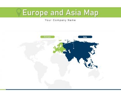 Europe and asia map continents political world geographical icon showing
If you require a professional template with great design, then this Europe And Asia Map Continents Political World Geographical Icon Showing is an ideal fit for you. Deploy it to enthrall your audience and increase your presentation threshold with the right graphics, images, and structure. Portray your ideas and vision using twelve slides included in this complete deck. This template is suitable for expert discussion meetings presenting your views on the topic. With a variety of slides having the same thematic representation, this template can be regarded as a complete package. It employs some of the best design practices, so everything is well-structured. Not only this, it responds to all your needs and requirements by quickly adapting itself to the changes you make. This PPT slideshow is available for immediate download in PNG, JPG, and PDF formats, further enhancing its usability. Grab it by clicking the download button.
-
 Romania map political map country map continent illustration romania
If you require a professional template with great design, then this Romania Map Political Map Country Map Continent Illustration Romania is an ideal fit for you. Deploy it to enthrall your audience and increase your presentation threshold with the right graphics, images, and structure. Portray your ideas and vision using twelve slides included in this complete deck. This template is suitable for expert discussion meetings presenting your views on the topic. With a variety of slides having the same thematic representation, this template can be regarded as a complete package. It employs some of the best design practices, so everything is well-structured. Not only this, it responds to all your needs and requirements by quickly adapting itself to the changes you make. This PPT slideshow is available for immediate download in PNG, JPG, and PDF formats, further enhancing its usability. Grab it by clicking the download button.
-
 Africa Continent Political Division Black Silhouette Puzzle Pieces
If you require a professional template with great design, then this Africa Continent Political Division Black Silhouette Puzzle Pieces is an ideal fit for you. Deploy it to enthrall your audience and increase your presentation threshold with the right graphics, images, and structure. Portray your ideas and vision using twelve slides included in this complete deck. This template is suitable for expert discussion meetings presenting your views on the topic. With a variety of slides having the same thematic representation, this template can be regarded as a complete package. It employs some of the best design practices, so everything is well-structured. Not only this, it responds to all your needs and requirements by quickly adapting itself to the changes you make. This PPT slideshow is available for immediate download in PNG, JPG, and PDF formats, further enhancing its usability. Grab it by clicking the download button.
-
 Australia Continent Map Icon National Flag Survey
Deliver a credible and compelling presentation by deploying this Australia Continent Map Icon National Flag Survey. Intensify your message with the right graphics, images, icons, etc. presented in this complete deck. This PPT template is a great starting point to convey your messages and build a good collaboration. The twelve slides added to this PowerPoint slideshow helps you present a thorough explanation of the topic. You can use it to study and present various kinds of information in the form of stats, figures, data charts, and many more. This Australia Continent Map Icon National Flag Survey PPT slideshow is available for use in standard and widescreen aspects ratios. So, you can use it as per your convenience. Apart from this, it can be downloaded in PNG, JPG, and PDF formats, all completely editable and modifiable. The most profound feature of this PPT design is that it is fully compatible with Google Slides making it suitable for every industry and business domain.
-
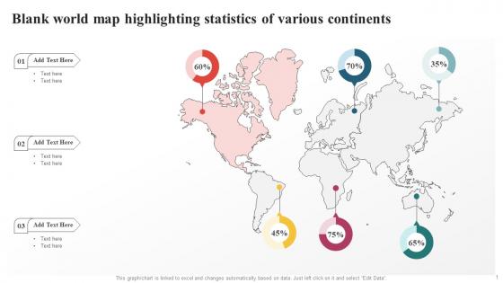 Blank World Map Highlighting Statistics Of Various Continents
Introducing our Blank World Map Highlighting Statistics Of Various Continents set of slides. The topics discussed in these slides are Blank Political Map Of The World, World Map Statistics, World Map With Continents. This is an immediately available PowerPoint presentation that can be conveniently customized. Download it and convince your audience.
-
 Globe Puzzle Image Hand Company Slogan Continents Shadow
This complete deck covers various topics and highlights important concepts. It has PPT slides which cater to your business needs. This complete deck presentation emphasizes Globe Puzzle Image Hand Company Slogan Continents Shadow and has templates with professional background images and relevant content. This deck consists of total of ten slides. Our designers have created customizable templates, keeping your convenience in mind. You can edit the colour, text and font size with ease. Not just this, you can also add or delete the content if needed. Get access to this fully editable complete presentation by clicking the download button below.
-
 Subarctic Continental Climate In Powerpoint And Google Slides Cpb
Presenting Subarctic Continental Climate In Powerpoint And Google Slides Cpb slide which is completely adaptable. The graphics in this PowerPoint slide showcase four stages that will help you succinctly convey the information. In addition, you can alternate the color, font size, font type, and shapes of this PPT layout according to your content. This PPT presentation can be accessed with Google Slides and is available in both standard screen and widescreen aspect ratios. It is also a useful set to elucidate topics like Subarctic Continental Climate. This well-structured design can be downloaded in different formats like PDF, JPG, and PNG. So, without any delay, click on the download button now.
-
 Continental Business Systems In Powerpoint And Google Slides Cpb
Presenting Continental Business Systems In Powerpoint And Google Slides Cpb slide which is completely adaptable. The graphics in this PowerPoint slide showcase Three stages that will help you succinctly convey the information. In addition, you can alternate the color, font size, font type, and shapes of this PPT layout according to your content. This PPT presentation can be accessed with Google Slides and is available in both standard screen and widescreen aspect ratios. It is also a useful set to elucidate topics like Continental Business Systems This well-structured design can be downloaded in different formats like PDF, JPG, and PNG. So, without any delay, click on the download button now.
-
 Unlabeled Map Of Africa Continent With Ethiopia
Introducing our premium set of slides with Unlabeled Map Of Africa Continent With Ethiopia. Ellicudate the three stages and present information using this PPT slide. This is a completely adaptable PowerPoint template design that can be used to interpret topics like Unlabeled Map Of Africa, Continent With Ethiopia. So download instantly and tailor it with your information.
-
 Continents Cut Outs In Powerpoint And Google Slides Cpb
Presenting Continents Cut Outs In Powerpoint And Google Slides Cpb slide which is completely adaptable. The graphics in this PowerPoint slide showcase three stages that will help you succinctly convey the information. In addition, you can alternate the color, font size, font type, and shapes of this PPT layout according to your content. This PPT presentation can be accessed with Google Slides and is available in both standard screen and widescreen aspect ratios. It is also a useful set to elucidate topics like Continents Cut Outs. This well structured design can be downloaded in different formats like PDF, JPG, and PNG. So, without any delay, click on the download button now.
-
 Continental Airlines Partners In Powerpoint And Google Slides Cpb
Presenting our Continental Airlines Partners In Powerpoint And Google Slides Cpb PowerPoint template design. This PowerPoint slide showcases three stages. It is useful to share insightful information on Continental Airlines Partners This PPT slide can be easily accessed in standard screen and widescreen aspect ratios. It is also available in various formats like PDF, PNG, and JPG. Not only this, the PowerPoint slideshow is completely editable and you can effortlessly modify the font size, font type, and shapes according to your wish. Our PPT layout is compatible with Google Slides as well, so download and edit it as per your knowledge.
-
 Blank Political Map Of Africa Continent
Introducing our premium set of slides with Blank Political Map Of Africa Continent. Ellicudate the three stages and present information using this PPT slide. This is a completely adaptable PowerPoint template design that can be used to interpret topics like Blank Political Map, Africa Continent. So download instantly and tailor it with your information.
-
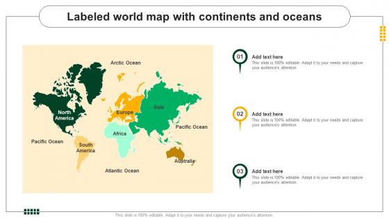 Labeled World Map With Continents And Oceans
Presenting our set of slides with Labeled World Map With Continents And Oceans This exhibits information on three stages of the process. This is an easy to edit and innovatively designed PowerPoint template. So download immediately and highlight information on Labeled World Map, Continents And Oceans.
-
 Bentley Continental Review In Powerpoint And Google Slides Cpb
Presenting Bentley Continental Review In Powerpoint And Google Slides Cpb slide which is completely adaptable. The graphics in this PowerPoint slide showcase four stages that will help you succinctly convey the information. In addition, you can alternate the color, font size, font type, and shapes of this PPT layout according to your content. This PPT presentation can be accessed with Google Slides and is available in both standard screen and widescreen aspect ratios. It is also a useful set to elucidate topics like Bentley Continental Review. This well structured design can be downloaded in different formats like PDF, JPG, and PNG. So, without any delay, click on the download button now.
-
 Continental Produce In Powerpoint And Google Slides Cpb
Presenting Continental Produce In Powerpoint And Google Slides Cpb slide which is completely adaptable. The graphics in this PowerPoint slide showcase three stages that will help you succinctly convey the information. In addition, you can alternate the color, font size, font type, and shapes of this PPT layout according to your content. This PPT presentation can be accessed with Google Slides and is available in both standard screen and widescreen aspect ratios. It is also a useful set to elucidate topics like Continental Produce. This well structured design can be downloaded in different formats like PDF, JPG, and PNG. So, without any delay, click on the download button now.
-
 Bentley Continental Flying Spur Price In Powerpoint And Google Slides Cpb
Presenting our Bentley Continental Flying Spur Price In Powerpoint And Google Slides Cpb PowerPoint template design. This PowerPoint slide showcases four stages. It is useful to share insightful information on Bentley Continental Flying Spur Price This PPT slide can be easily accessed in standard screen and widescreen aspect ratios. It is also available in various formats like PDF, PNG, and JPG. Not only this, the PowerPoint slideshow is completely editable and you can effortlessly modify the font size, font type, and shapes according to your wish. Our PPT layout is compatible with Google Slides as well, so download and edit it as per your knowledge.
-
 Continental Market Cap In Powerpoint And Google Slides Cpb
Presenting our Continental Market Cap In Powerpoint And Google Slides Cpb PowerPoint template design. This PowerPoint slide showcases six stages. It is useful to share insightful information on Continental Market Cap This PPT slide can be easily accessed in standard screen and widescreen aspect ratios. It is also available in various formats like PDF, PNG, and JPG. Not only this, the PowerPoint slideshow is completely editable and you can effortlessly modify the font size, font type, and shapes according to your wish. Our PPT layout is compatible with Google Slides as well, so download and edit it as per your knowledge.
-
 Continents Of Africa And Asia Map
Presenting our set of slides with Continents Of Africa And Asia Map. This exhibits information on three stages of the process. This is an easy to edit and innovatively designed PowerPoint template. So download immediately and highlight information on Continents, Africa, Asia.
-
 Map Showing Continent Of Asia
Presenting our set of slides with Map Showing Continent Of Asia. This exhibits information on three stages of the process. This is an easy to edit and innovatively designed PowerPoint template. So download immediately and highlight information on Continent, Showing, Asia.
-
 The Continent Of Asia Map Including China And India
Introducing our premium set of slides with The Continent Of Asia Map Including China And India. Ellicudate the Three stages and present information using this PPT slide. This is a completely adaptable PowerPoint template design that can be used to interpret topics like Continent, Including, Asia. So download instantly and tailor it with your information.
-
 Continental Automotive Revenue In Powerpoint And Google Slides Cpb
Presenting our Continental Automotive Revenue In Powerpoint And Google Slides Cpb PowerPoint template design. This PowerPoint slide showcases four stages. It is useful to share insightful information on Continental Automotive Revenue This PPT slide can be easily accessed in standard screen and widescreen aspect ratios. It is also available in various formats like PDF, PNG, and JPG. Not only this, the PowerPoint slideshow is completely editable and you can effortlessly modify the font size, font type, and shapes according to your wish. Our PPT layout is compatible with Google Slides as well, so download and edit it as per your knowledge.
-
 United Continental Holdings Stock In Powerpoint And Google Slides Cpb
Presenting our United Continental Holdings Stock In Powerpoint And Google Slides Cpb PowerPoint template design. This PowerPoint slide showcases four stages. It is useful to share insightful information on United Continental Holdings Stock. This PPT slide can be easily accessed in standard screen and widescreen aspect ratios. It is also available in various formats like PDF, PNG, and JPG. Not only this, the PowerPoint slideshow is completely editable and you can effortlessly modify the font size, font type, and shapes according to your wish. Our PPT layout is compatible with Google Slides as well, so download and edit it as per your knowledge.
-
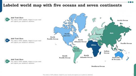 Labeled World Map With Five Oceans And Seven Continents
Presenting our set of slides with Labeled World Map With Five Oceans And Seven Continents. This exhibits information on three stages of the process. This is an easy to edit and innovatively designed PowerPoint template. So download immediately and highlight information on World Map With Oceans And Seas, Political World Map With Oceans, Political Map Of The World, World Map Outline.
-
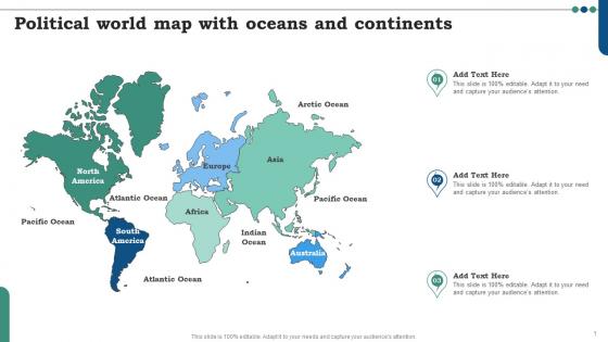 Political World Map With Oceans And Continents
Introducing our premium set of slides with Political World Map With Oceans And Continents. Ellicudate the three stages and present information using this PPT slide. This is a completely adaptable PowerPoint template design that can be used to interpret topics like World Map With Oceans And Seas, Political World Map With Oceans, Political Map Of The World, World Map Outline. So download instantly and tailor it with your information.
-
 Continental Travels In Powerpoint And Google Slides Cpb
Presenting our Continental Travels In Powerpoint And Google Slides Cpb PowerPoint template design. This PowerPoint slide showcases six stages. It is useful to share insightful information on Continental Travels This PPT slide can be easily accessed in standard screen and widescreen aspect ratios. It is also available in various formats like PDF, PNG, and JPG. Not only this, the PowerPoint slideshow is completely editable and you can effortlessly modify the font size, font type, and shapes according to your wish. Our PPT layout is compatible with Google Slides as well, so download and edit it as per your knowledge.
-
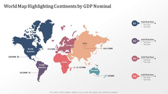 World Map Highlighting Continents By GDP Nominal
Presenting our set of slides with World Map Highlighting Continents By GDP Nominal This exhibits information on four stages of the process. This is an easy to edit and innovatively designed PowerPoint template. So download immediately and highlight information on 7 Continents Of The World Map, Political World Map With Continents, World Continents And Regions Map, Continents And Oceans Map
-
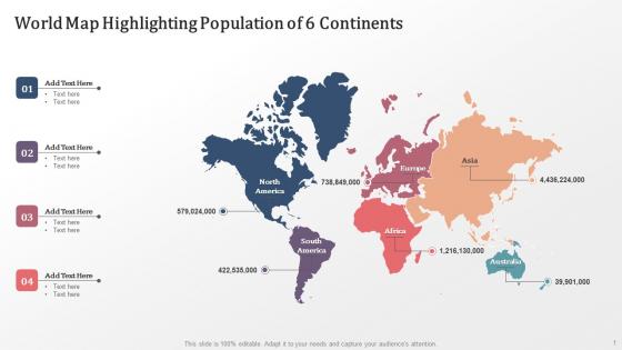 World Map Highlighting Population Of 6 Continents
Introducing our premium set of slides with World Map Highlighting Population Of 6 Continents Ellicudate the four stages and present information using this PPT slide. This is a completely adaptable PowerPoint template design that can be used to interpret topics like 7 Continents Of The World Map, Political World Map With Continents, World Continents And Regions Map, Continents And Oceans Map So download instantly and tailor it with your information.
-
 Continental Hospitals In Powerpoint And Google Slides Cpb
Presenting our Continental Hospitals In Powerpoint And Google Slides Cpb PowerPoint template design. This PowerPoint slide showcases four stages. It is useful to share insightful information on Continental Hospitals. This PPT slide can be easily accessed in standard screen and widescreen aspect ratios. It is also available in various formats like PDF, PNG, and JPG. Not only this, the PowerPoint slideshow is completely editable and you can effortlessly modify the font size, font type, and shapes according to your wish. Our PPT layout is compatible with Google Slides as well, so download and edit it as per your knowledge.
-
 Continental Margin Features In Powerpoint And Google Slides Cpb
Presenting Continental Margin Features In Powerpoint And Google Slides Cpb slide which is completely adaptable. The graphics in this PowerPoint slide showcase three stages that will help you succinctly convey the information. In addition, you can alternate the color, font size, font type, and shapes of this PPT layout according to your content. This PPT presentation can be accessed with Google Slides and is available in both standard screen and widescreen aspect ratios. It is also a useful set to elucidate topics like Continental Margin Features. This well structured design can be downloaded in different formats like PDF, JPG, and PNG. So, without any delay, click on the download button now.
-
 Continental Casting In Powerpoint And Google Slides Cpb
Presenting our Continental Casting In Powerpoint And Google Slides Cpb PowerPoint template design. This PowerPoint slide showcases three stages. It is useful to share insightful information on Continental Casting This PPT slide can be easily accessed in standard screen and widescreen aspect ratios. It is also available in various formats like PDF, PNG, and JPG. Not only this, the PowerPoint slideshow is completely editable and you can effortlessly modify the font size, font type, and shapes according to your wish. Our PPT layout is compatible with Google Slides as well, so download and edit it as per your knowledge.
-
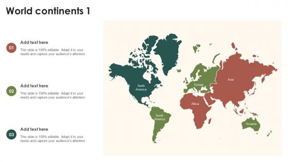 World Continents 1 PU Maps SS
Introducing our premium set of slides with World Continents 1 PU Maps SS. Ellicudate the three stages and present information using this PPT slide. This is a completely adaptable PowerPoint template design that can be used to interpret topics like World Continents 1. So download instantly and tailor it with your information.


