Powerpoint Templates and Google slides for Population Density Map
Save Your Time and attract your audience with our fully editable PPT Templates and Slides.
-
 Population Density Map Of China Country
This slide shows population density map of China country in all region with Fujian and Hunan as most populated areas with density of about 800-900 per km sq. Introducing our premium set of slides with Population Density Map Of China Country. Ellicudate the three stages and present information using this PPT slide. This is a completely adaptable PowerPoint template design that can be used to interpret topics like Population Density, Map Of China Country. So download instantly and tailor it with your information.
-
 New Zealand Population Density Map
This slide shows population density map of various regions in country of New Zealand with Wellington as the most populated province of contry. Introducing our premium set of slides with New Zealand Population Density Map. Ellicudate the three stages and present information using this PPT slide. This is a completely adaptable PowerPoint template design that can be used to interpret topics like New Zealand, Population Density Map. So download instantly and tailor it with your information.
-
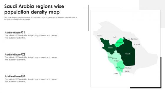
 Saudi Arabia Regions Wise Population Density Map
This slide shows population density in various regions of Saudi Arabia country with Mecca and AIBahah as the most populated region and areas Presenting our set of slides with Saudi Arabia Regions Wise Population Density Map This exhibits information on three stages of the process. This is an easy to edit and innovatively designed PowerPoint template. So download immediately and highlight information on Saudi Arabia Regions Wise, Population Density Map
-
 Map Of Africa Showing Population Density In Nigeria
Presenting our set of slides with Map Of Africa Showing Population Density In Nigeria. This exhibits information on three stages of the process. This is an easy to edit and innovatively designed PowerPoint template. So download immediately and highlight information on Political Map Of Nigeria, Map Of Nigeria, Nigeria Map With States, Nigeria Population Map.
-
 Italy State Wise Population Density Map
This slide shows population of every state in Italy with Campania and Lombardy as most populous areas with population of about more than 400 persons per sq. km Introducing our premium set of slides with Italy State Wise Population Density Map. Ellicudate the five stages and present information using this PPT slide. This is a completely adaptable PowerPoint template design that can be used to interpret topics like Population, Density, Map. So download instantly and tailor it with your information.
-
 Map of belgium and venezuela with population density percentage powerpoint slides
Presenting map of belgium and venezuela with population density percentage powerpoint slides. This Power Point template slide has been crafted with graphic of maps for Belgium and Venezuela. This PPT slide contains the concept of population density representation. Use this PPT slide for business and marketing related presentations.
-
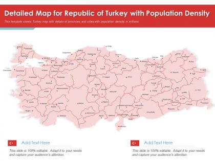
 Detailed map for republic of turkey with population density powerpoint presentation ppt template
Nail your next presentation by using this Detailed Map For Republic Of Turkey With Population Density Powerpoint Presentation PPT Template. This template allows the users to highlight, map and present the geographical features of the country with ease. Visual representation of the location of a country, state, city, etc, can be easily dealt with this map PowerPoint template. You can also use it to highlight the target market for an important sales meeting. Therefore, easily implement the color-coded legend and create a high-quality map design with this template. All the features of this design, come in an editable format which makes it easy-to-use and apply. Best of all, you can use this PowerPoint template as a standalone slide or integrate it into a different set of presentations to enhance the delivery process.
-
 USA States Population Density Map
This slide shows United states population density with district of Columbia as most dense state with average population of 4361 per km sq. Presenting our set of slides with USA States Population Density Map. This exhibits information on four stages of the process. This is an easy to edit and innovatively designed PowerPoint template. So download immediately and highlight information on Population, Density, Average.


